Pages

Saturday, February 12, 2011

The Ubuntu Project - Research

Use this link to investigate and learn about  KIPP school.

 Find:
  • Five things our schools have in common
  • Five things the students have in common
  • Prepare three questions that you would like your group leaders to ask when they meet up with the KIPP students.
If you want to understand the true value of an excellent education for those who don't take it for granted, follow this link and watch the video.

http://www.kippcharlotte.org/aboutus.htm

This video below gives a little history about the organization


H/W is due for Tuesday

Thursday, February 10, 2011

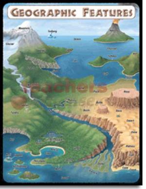
Geographical Features

Feel free to add your typed grographical features to the blog text for comments/suggestions.

Tomorrow, I  will be putting somebody's work on the blog as a mentor text for others to see. Will it be yours?

Tuesday, February 8, 2011

Geographical Features Mentor Text

What lessons can you learn for the mentor text on geogrpahcal features below written by Robert fuller last year? What techniques can you extract from his writing and apply to your own?

The flapping wings of the brown pelican, Louisiana’s state bird, fill the air as it soars over the ravishing, earthy scented marshland looking for a place to land. Imagine a boot-shaped fertile land of damp, breath-taking marshes, and the ground is partly underwater. The state of Louisiana is truly that place. Louisiana’s unique setting causes a number of this beautiful, marshy wonderland’s terrain features. Because Louisiana sits in one of the closest areas to the equator, it receives ample sunlight. The three states that border Louisiana are Alabama, Texas, and Mississippi. Additionally, this spectacular haven is located in the Southeast region and in the East South Central sub-region. Louisiana overlooks the Gulf of Mexico, so this paradise receives an abundance of dreadful storms during hurricane season.


One simply could not speak of Louisiana without mentioning its bustling cities. Not only is Louisiana home to numerous thriving metropolises, but nearly 75% of Louisiana’s population lives in urban or suburban areas. New Orleans, the most densely populated city in this beautiful state, is the 38th largest town in the United States. Baton Rouge, the second most populous boomtown in Louisiana, has reigned as the state capital since 1882. The third significant city is Shreveport; furthermore, it is the cultural center of the Ark-La-Tex, the area where Arkansas, Texas, and Louisiana meet.

Because of all its marshes, lakes, and rivers, the state of Louisiana is often thought of as sodden wetland. In fact, Louisiana is one-third water. The rustling Mississippi River depositing into the Gulf of Mexico impacts both the geography and industries of Louisiana. The mouth of the river has changed the shape of the land in the south of Louisiana and improved the fishing industry. For example, New Orleans sits on land created by silt that the Mississippi carries. This beautiful state has countless lakes, including the rippling, 600 square mile Lake Pontchartain. The Louisiana coastline stretches 397 miles along the Gulf of Mexico. The Gulf of Mexico ranks as planet Earth’s 5th largest body of water.

Louisiana cannot boast of the lofty mountains of Alaska, but soggy textured bayous, a common feature in Louisiana, are unique in the nation. A bayou is a slow moving body of water connected to a river, ocean, or lake. Either saltwater, freshwater, or brackish water, a mixture between the earlier two, can be found in a typical bayou. Historian Harnett Kane described bayous as, “A place that seems often unable to make up its mind whether to be earth or water, and so it compromises.”¹ Few people live in bayous, but they remain a beautiful part of the state.

The low land is another factor that renders Louisiana’s geography unique. Although Driskill Mountain, the highest elevation in Louisiana, is just a hill at 935 feet above sea level, the peak stands as sky scraping to Louisiana as Mt. Everest is to Nepal. Additionally, Louisiana’s low point, New Orleans, is actually nine feet below sea level. This statistic explains why hurricane waves are a quandary in the city. Sadly, citizens are forced to make levees, walls made to regulate a body of water. The average elevation in the Pelican State is a lowly 90 feet. Wetland to the south, flat plains in the middle and a few lush forests to the north combine to give Louisiana very little altitude. The brown pelican flies down into a bayou, and lands on a bald cypress, Louisiana’s state tree. The only noise is the buzz of a honeybee, the state insect.

¹Louisiana by Suzanne LeVert

Now - How good will your geographical features component be?

Sunday, February 6, 2011

State Report - This Week

Will you have a minimum of 5 stickers by the end of this week?

Thursday, February 3, 2011

State Report Websites


State Report Websites

Use 'only' these sites below to do your State Report online research. If you find a site on your own that you think is better, share it with me first, and I might add it to the list. There is advice under each website to save you a little time.

State Report Websites

1. Encyclopedia Britannica Online School Edition: http://school.eb.com/elementary  [ID=latin, PASSWORD=hawks] You may copy a picture or map from this site. Type the name of your state in the Search box and click Go.

2. NETSTATE.com
Advice: (Only good for basic facts about the states)

3. IPL Kidspace: Stately Knowledge: http://www.ipl.org/div/kidspace/stateknow/  provides basic facts and links to other sources about each state

Advice: (Use the links at the bottom of each state page for detailed information on specific topics)

4. Infoplease: The Fifty States: http://www.infoplease.com/states.html  Choose state from the list below the map.

(Advice – Good for geographical features and commerce and industry)

6.  http://www.usworldbook.com/

7. http://en.wikipedia.org/wiki/North_carolina#Geography
You will need to type in YOUR STATE NAME
Related Posts Plugin for WordPress, Blogger...